Leona Heights Pigment Maps
Abstract wearable maps to Leona Heights Park by Kasey

Leona Heights Watercolor Map
Oakland’s Leona Heights neighborhood is an altered landscape. For beneath the roots and the roads lies a network of old gold, pyrite, gravel, and pigment mines. Most of this earthwork can be traced to one man - Fritz Boehmer - one of the founding fathers of Alameda. An experienced miner and serial entrepreneur, in the late 19th century he strip mined the Ohlone’s red ochre source via his San Francisco Mineral Paint Company. Dressing the city’s painted ladies ripped open a jagged seam through the hills. Very little of the red stone now remains – although other shades of ochre can still be found. I decided to investigate — and celebrate — these remaining fragments of the seam in the form of two functional jewelry pieces that showcase ochre in both it’s pigment and paint forms.
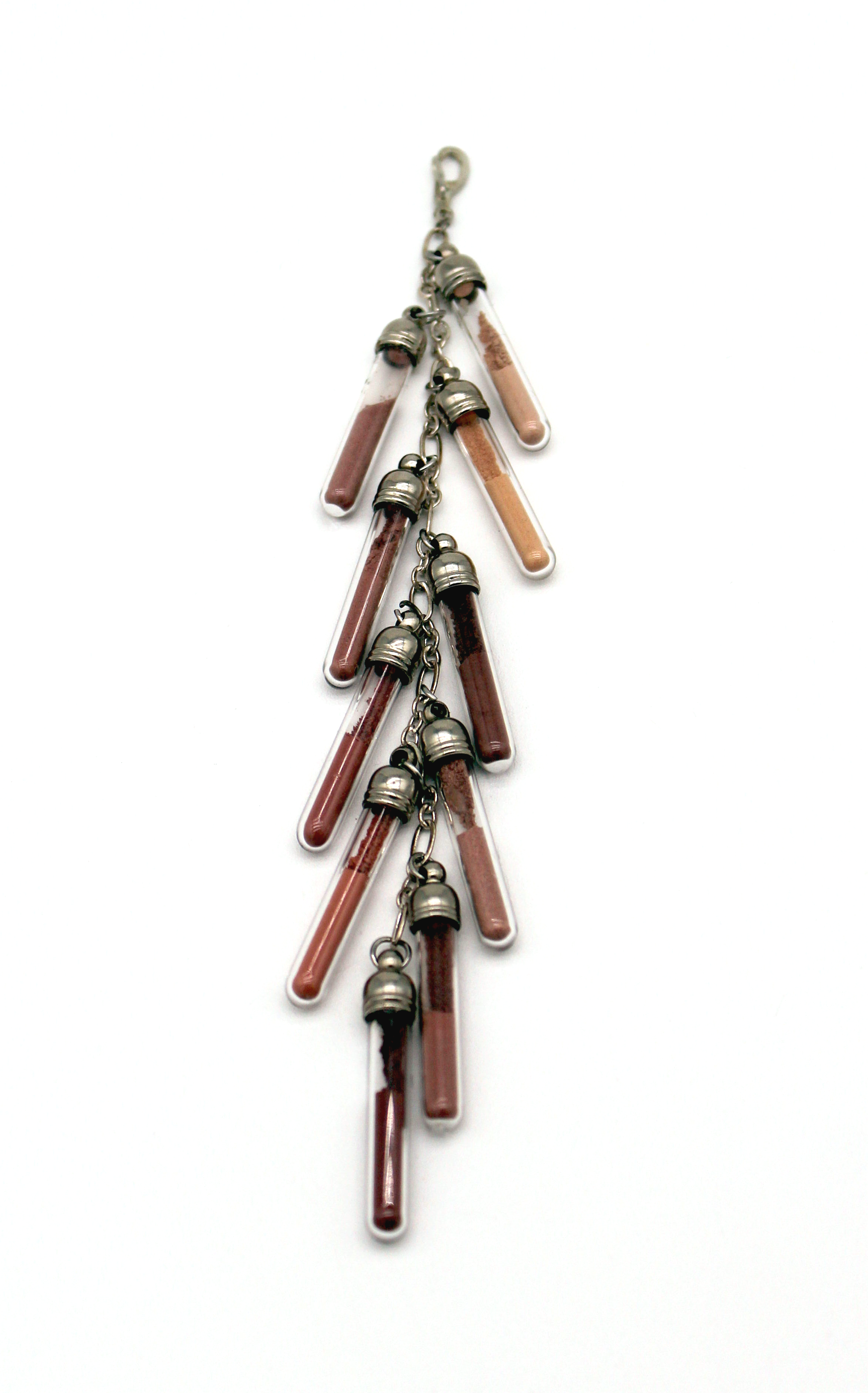
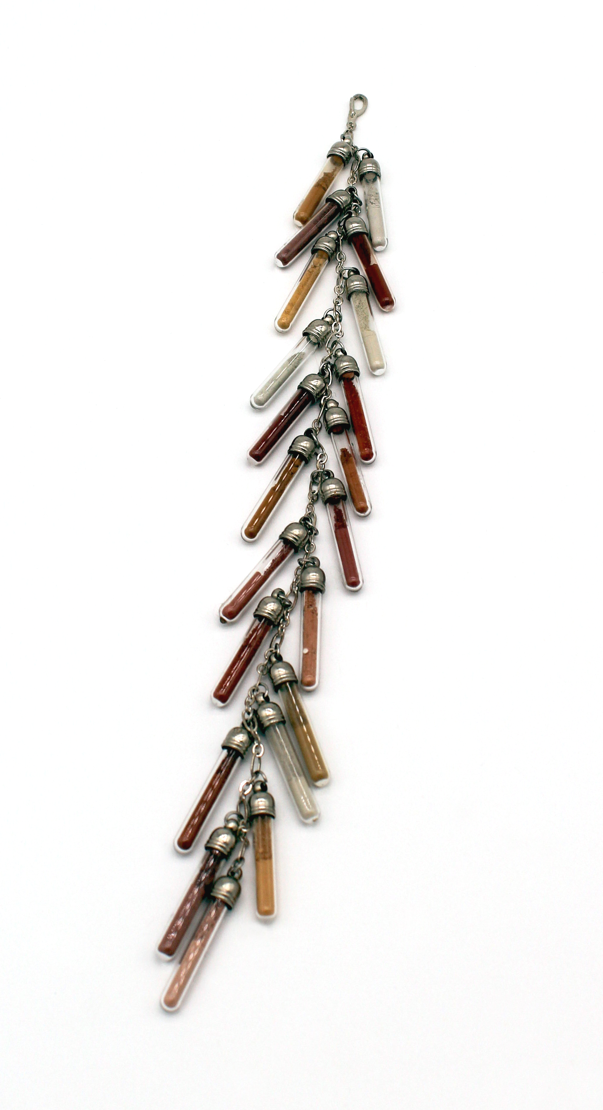
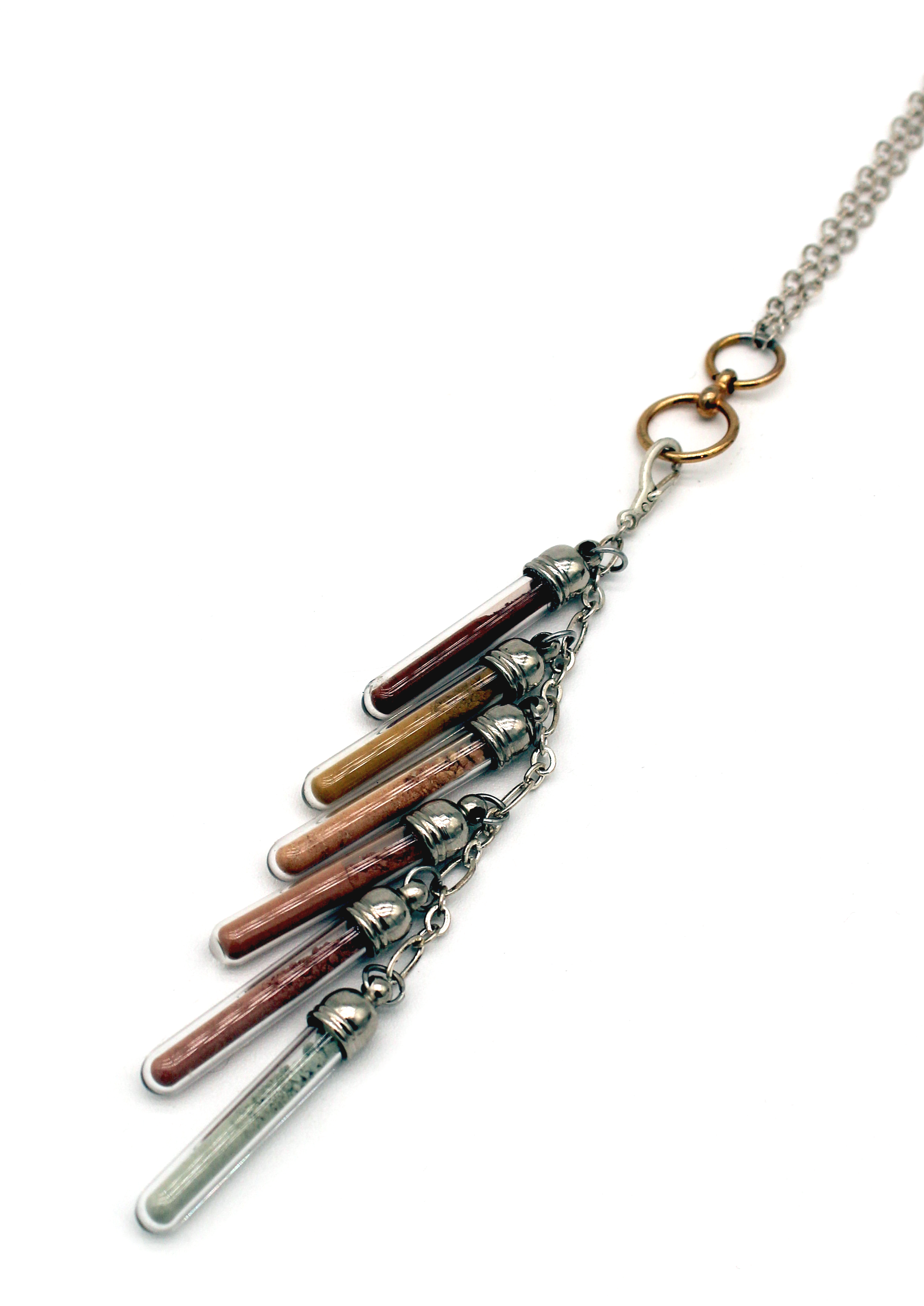
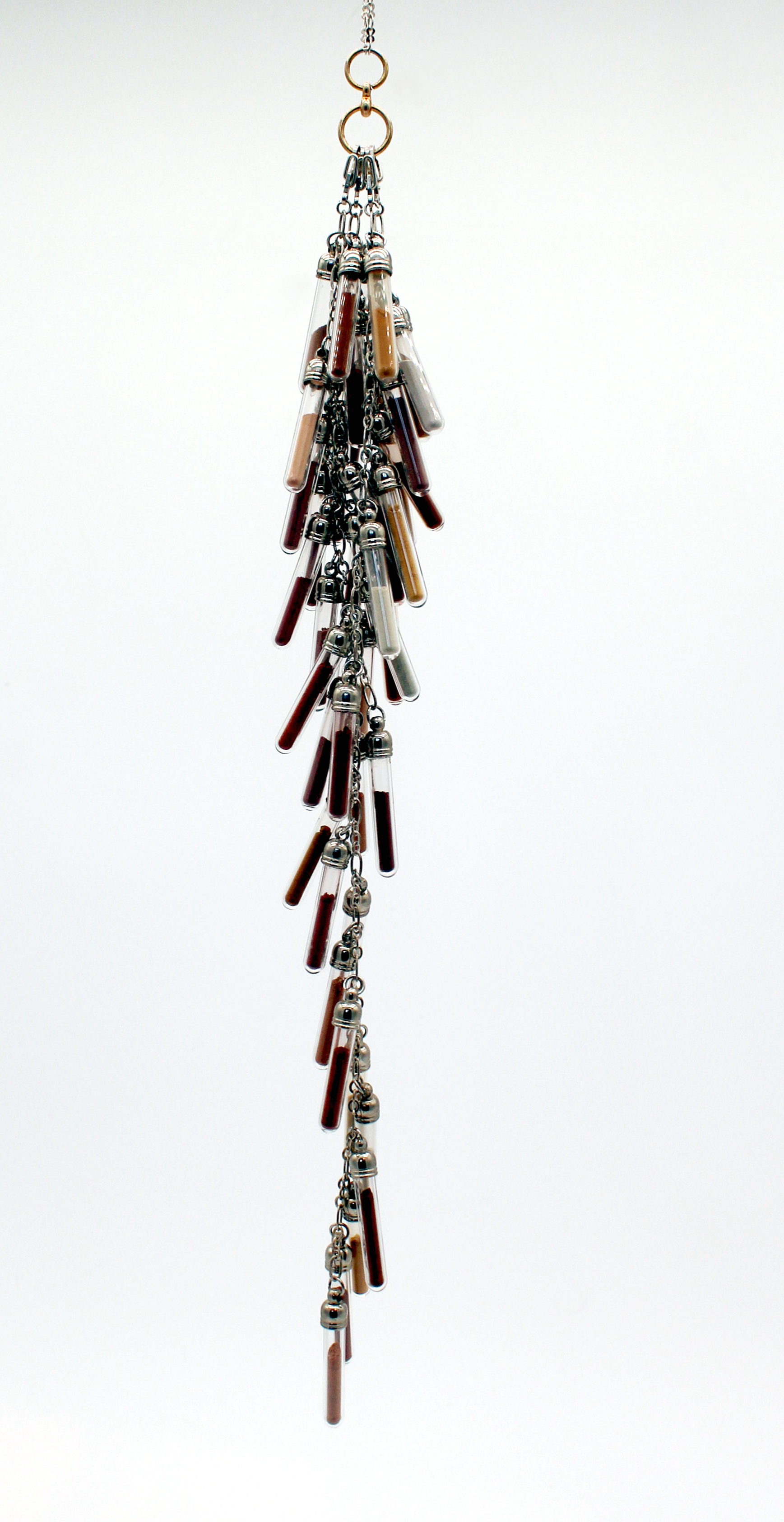
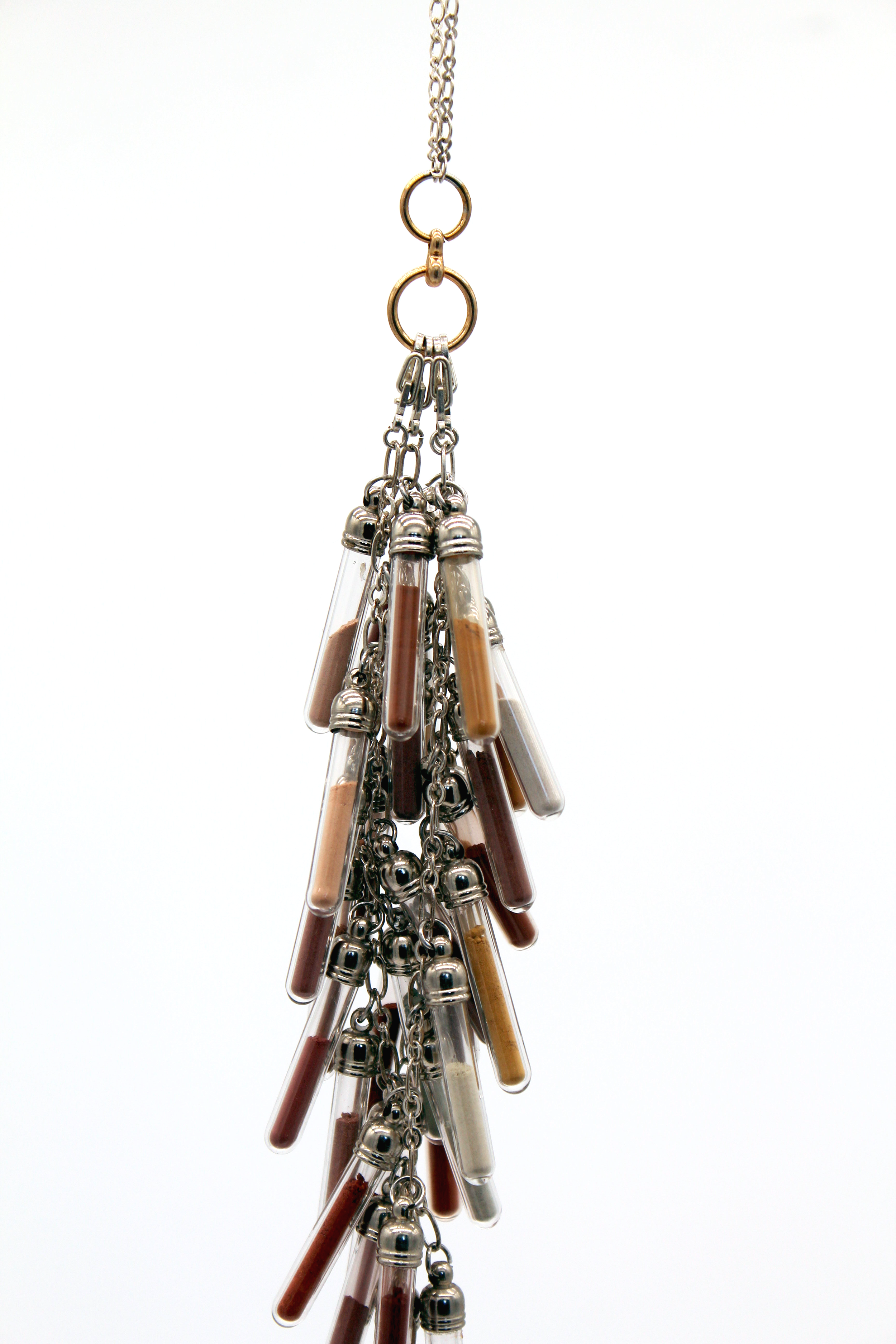
Map #1 Leona Heights Pigment Maps

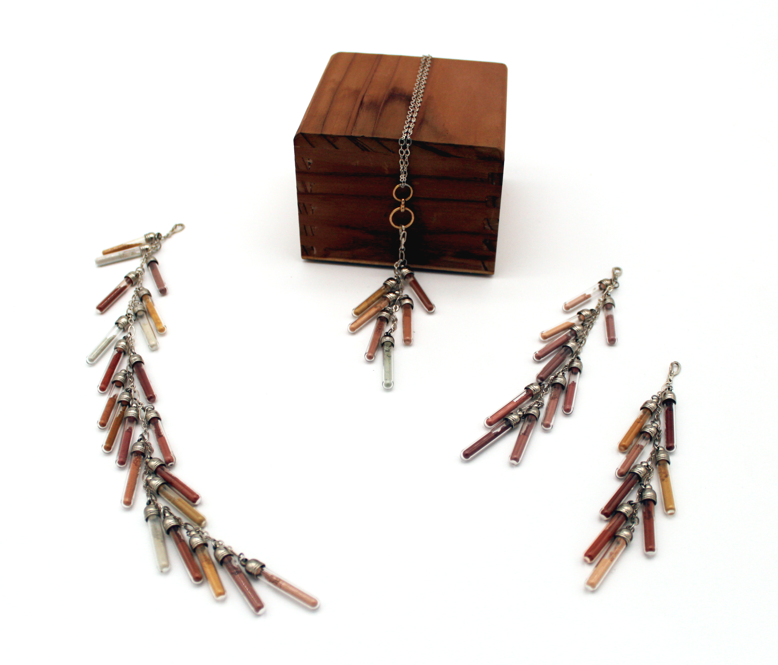
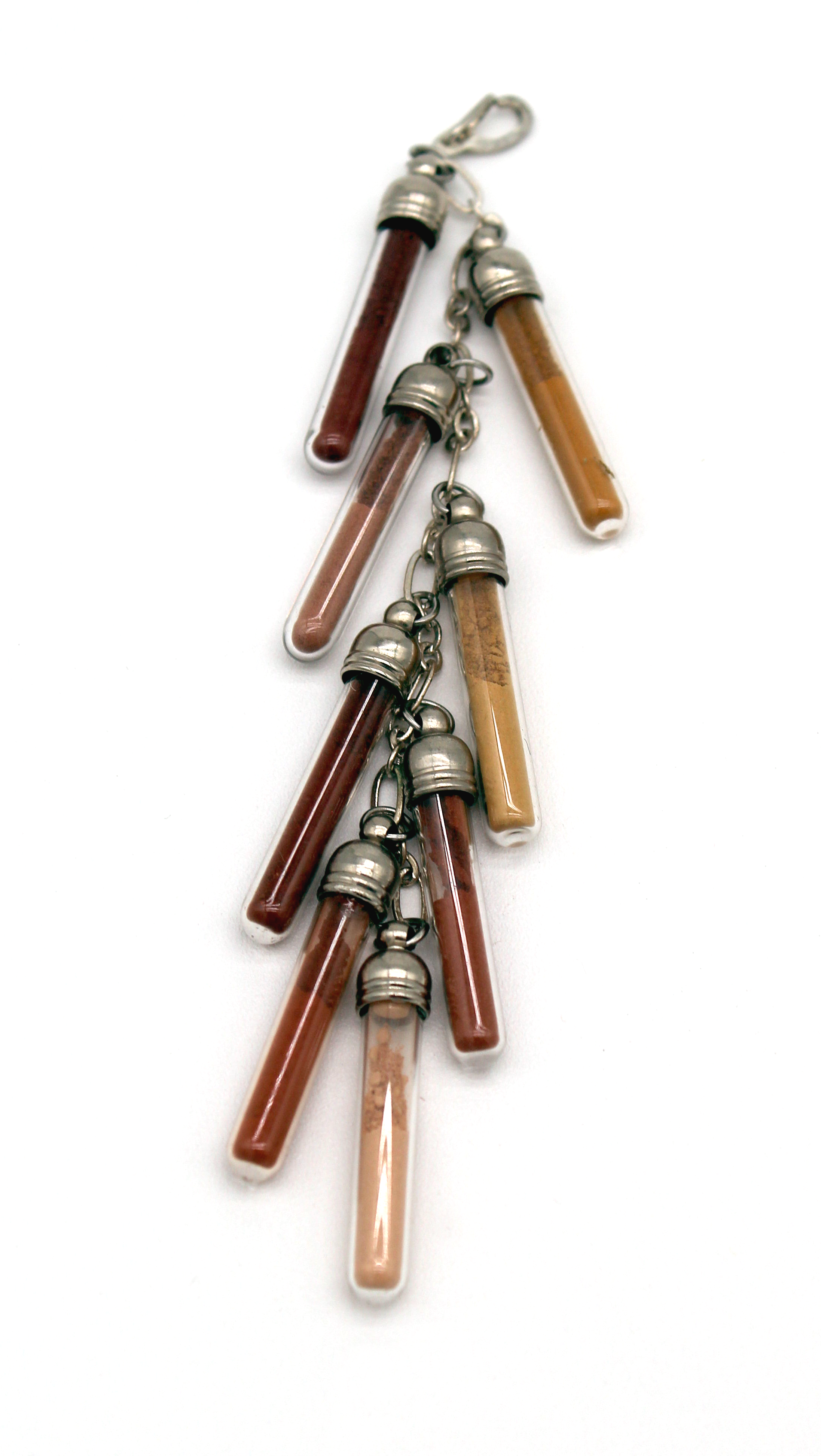
Comprised of a necklace with four interchangeable strands of pigment vials, this piece documents the ochres found on four specific hikes/walks in Oakland’s Leona Heights neighborhood. Aggressively mined in the 19th century and built upon in the 20th, the ochre deposits have been fragmented and may elude novice eyes. These necklaces document not only the variety of these local ochres, but their locations and the order the wearer may encounter them in.
These strands function as guided walking tours through the geology and history of this area. By clipping on a stand and walking the represented path, the wearer can directly experience the arc of human intervention on the Oakland Hills.
The longest strand with the most variety belongs to the York Trail. A hiking path traveling through a deep, wooded ravine, it is the most “natural” pathway of the four. Fun Fact — the oldest redwood in the Bay Area can be found just off the York Trail. The shortest strand belongs to the Leona Heights Mine - the location of the underground pyrite mine that Fritz Boehmer founded at the turn of the last century. A former toxic waste site that used to make the adjacent creek run orange, it is the most heavily impacted of the paths. its ochre pulverized and remediated by the mine and its cleanup. The Mountain Blvd and Redwood Road strands were both ochre quarries that have since transitioned to residential and commercial uses. These paths take you through the shopping centers and single family homes that now dot the hills, giving brief flashes of the the original landscape along the way.


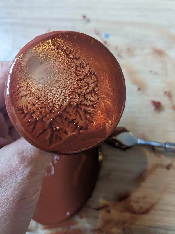
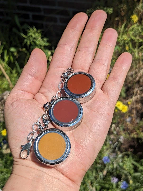
Map #2 - Leona Heights Watercolor Map
Comprised of a bracelet with three watercolor lockets, this piece is a wearable paint palette of Leona Heights ochres. It contains the three most common colorations in the deposit — red, yellow, and mauve. The stones were collected in a parking lot on Redwood Road, in the creek bed of York Trail, and in a cutout near Mountain Blvd. They were then ground, processed, and mulled into watercolor paint. Functional and mobile, the piece is designed to be taken out and used in situ. Why not paint Oakland with Oakland?