
Map making is never apolitical. Every line on the grid, every component in the legend, every syllable of the title represents a conscious decision about what is worth communicating, and conversely, what is not. Whole realms of understanding can be lost in the gap between what a map shows and what a place is actually like. For maps capture a narrowly and artificially constrained moment in the existence of a place. Maps show when the streets were laid out and named like so, and when both private development and civic infrastructure were in such and such a state. While they can show where a place came from or where it’s expected to go, they often struggle with holding the past, present, and future in a single frame, usually defaulting to showing one over the other.
For this series, I wanted to make maps that spoke to both the past and present of Oakland, in a way that was beautiful, noble, and intimate. I combined official city maps from 1950 and 2018 to gain insight into the city grid before and after the beginning of Oakland’s ongoing urban renewal campaigns. Combined into a single viewpoint, the pieces show the 2018 street grid in silver and the 1950 street grid in gold. The neighborhoods I chose to depict were as follows:
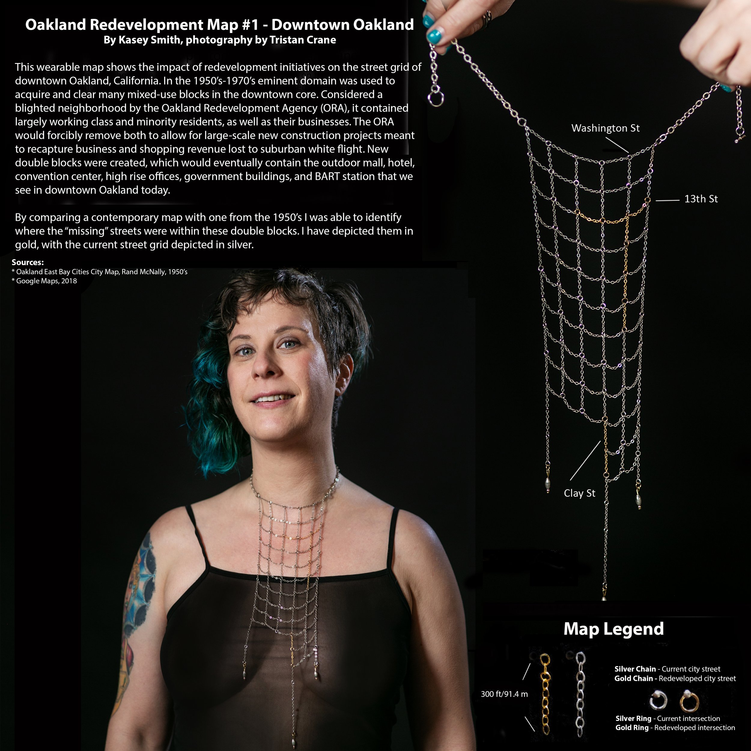
Oakland City Center - The City Center outdoor plaza and several of the adjacent skyscrapers exist because the city used eminent domain to clear out 10 square blocks of what was a mixed use commercial neighborhood.
West Oakland - Much of the neighborhood, including the original commercial corridor, was lost to build the BART station, the Post Office, and the 880.
Temescal - Building the BART and the Maze required removing numerous blocks of housing and turning many streets into dead ends.
Coliseum - While the two stadiums and 10,000 parking spots were largely built on an empty lot, their footprint, as well as that of BART, required moving and removing many streets in the area.


The City Center map can be seen in the 2023 Guerilla Cartography book Shelter: An Atlas. For this publication I choose to expand on the history of redevelopment initiatives in downtown Oakland, making the subtext of the original necklace more textual. The book can be downloaded or purchased from the Guerilla Cartography site.